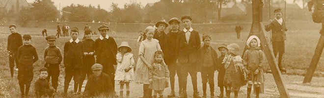
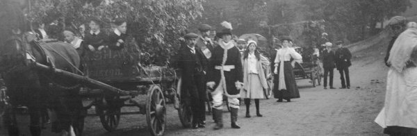

Origin of Street and Place Names
Many of the older streets in the Somercotes area were of special significance in the village history. The list below is not complete:
- Albert Street, Leabrooks: Named after Prince Albert, consort of Queen Victoria. This street dates from around the late 1800s.
- Bank Street, Somercotes: Originally this was a grass slope leading from the stone quarry up to Moss Farm. The farmhouse is around 400 years old.
- Barrack Yard, Lower Somercotes: This small development off Cinder Road, Lower Somercotes is probably named after barracks or dormitories erected in the very early 1800s for the single workers employed by the ironworks and collieries, or as temparary accommodation for married men until they could find suitable homes for their families.
- Beastall’s Corner, Somercotes: The old local name for the junction of Nottingham Road and High Street. At the head of the junction is Oporto House, which was an Off-Licence and Brewery owned by George Beastall, a prominent business man and magistrate in the first half of the 20th century. Since the closing of the Off-Licence in the late 1970s, the term has fallen into disuse.
- Brenden Avenue, Somercotes. Named after the builders who built most of the original houses, their surnames being Brentnall and Dennis.
- Birchwood Lane, Somercotes: Originally this was a lane through the woods leading down to Lower Birchwood. In medieval times it was spelled “Byrchwoode” . The only remains of the vast woodland that covered the area is now the Pennytown Nature Reserve.
- Bowns Yard, Somercotes: Named after Mr. Joseph Bown, who owned the land over which Quarry Road and Bowns Yard were built. Mr. Bown was an Urban Councillor, Guardian of the poor and a magistrate.
- Bramley Street, Lower Somercotes: Bramley Street is almost certainly named after the owner of the land or builder of the houses. There were several families with the surname Bramley living in the area in the early to mid-1800’s. John Bramley [born c.1801] was a farmer who was listed in the 1841 census, although there is no firm evidence that he was the person after whom Bramley Street was named.
- Brickyard, Somercotes: The brickyard is on the site of the old Lower Somercotes Brickworks.
- Cemetery Road, Leabrooks: This road was developed at the time that Leabrooks Cemetery was laid out in the late 1890's. It runs from the Hight Street through to the intersection of Bridle Lane and Albert Street, Leabrooks.
- Chapel Street, Leabrooks: named after the Free United Methodist Chapel that opened there in 1896. The chapel closed in 1973.
- Charles Street, Leabrooks: The land on which Charles Street is situated was owned by Mr. Charles Shaw, who also paid for its construction.
- Cinder Road, Somercotes: Cinder Road was an old cinder track leading from Lower Birchwood to Riddings.
- Cockshutt Lane, Lower Birchwood: This is an old name but the origin of the name at Birchwood is not clear. One explanation is that a “cockshutt” was a net which was suspended between two poles for catching woodcock, a game bird. Given that this was a wooded area long ago, this seems to be the most plausible explanation.
- Coupland Place, Somercotes: Named after John Coupland or his son Thomas. John Coupland and his son were coal-masters and had the houses built that were originally situated on Coupland Place for their workers. Most of the houses on Coupland Place were demolished in the 1970's and the area was re-developed, but the name was still kept for part of the new development.
- Erewash Street, Pye Bridge: Named after the River Erewash, which is nearby. The name Erewash itself is commonly accepted to derive from the Old English words irre ("wandering") and wisce ("wet meadow”).
- George Street (off Somercotes Hill) is named after the builder, George Naylor, and probably dates from around the mid-1800s. In some older documents such as census returns etc.. the street is often named "Naylor's Row"..
- High Street, Somercotes: This is probably the oldest street on waht used to be known as Somercotes Common prior to its development. It runs from the junction of Nottingham Road to Leabrooks Road.
- Hockley Way, Somercotes: The area to the south west of Alfreton roughly situated between the Swan & Salmon Inn and the A38 was, before being purchased by Robert Watchhorn and developed as a recreation ground, a wooded area known as Hockley. The name appears on old maps from the late 1890s. Hockley Way follows an old path from Nix’s Hill through to this area.
- Lower Somercotes: Somercotes Hill becomes Lower Somercotes at a point just before Cinder road and stretches through to Pye Bridge. This is the original Somercotes, which existed before the turnpike road (the B600) was constructed over Somercotes Common.
- Market Place, Somercotes: This is, in fact, the new Market Place, opened in 1896. Prior to this date the old Market Place was at the end of Coupland Place, where the Market Inn used to stand. The current area of the Market Place is now used as a car park, and was formally used for garaging County Council road vehicles [and before that carriages and carts]. Records show that a Market has not been held there since around 1900.
- Main Road, Leabrooks: This road used to be known as Greenhill Lane Road. It is called this on the Enclosure Maps of 1812. It is not known when the name was changed to Main Road.
- Main Road, Pye Bridge: This part of the B600 follows the ancient track that became part of the Newhaven-Nottingham Turnpike, which ran through Alfreton.
- Mill Street, Somercotes: named after a steam mill that was situated on the site of the Mill Street car park. It was built in 1845 by John Chadborn and originally called the Alfreton Steam Mill. Pigot’s Trade Directory of 1845 states that the mill engine was 35hp, and worked six pairs of stones for grinding corn.
- Muckram, Lower Birchwood: The hamlet of Muckram consisted of 26 houses and Swiss Cottage [the home of the manager of Birchwood Collieries]. The name was changed to New Birchwood in the late 1800’s but it still retained the old name locally. Muckram was sold in its entirety in 1942 and the cottages were demolished, leaving only the Swiss Cottage now standing. Muckram is an old name, now no longer in use, and its origin seems to have been lost in time
- Nix’s Hill, Somercotes: On most modern maps now this is referred to as part of Nottingham Road. It stretched from the A38, up to Hockley Way, now the entrance to the Nix’s Hill Trading Estate, which was named after this section of the B600. The hill was named after John Nix, a stud farmer of Outseats, Alfreton, who owned the land prior to the construction of the new road (the B600).
- Quarry Road, Somercotes: The road was used as a path along the top of a stone quarry.
- Queen Street, Somercotes: Another name deriving from Queen Victoria and dating from the late 1800s.
- Seely Terrace, Somercotes: Named after Sir Charles Seely, coal-master and benefactor, who had the houses built for his workers.
- Sleetmoor Lane, Somercotes: This was formerly known as Lee Lane, where the Lee Brook rose. The lane took the name from the Sleight Moor, an area further along the lane towards Swanwick and has been known as Sleetmoor Lane for many years.
- Smedley Avenue, Somercotes: Almost certainly named after John Smedley, the Matlock philanthropist who paid for the building of Birchwood Methodist Chapel.
- Smotherfly, Lower Birchwood: According to Reginald Johnson in his book “A History of Alfreton”, Smotherfly may have been known as “Smother Flee”, but the origin of the name is not known.
- Victoria Street, Somercotes: As the name implies, this street was named after Queen Victoria. The road was developed and houses were first constructed there in the 1890s.
- Wimsey Way, Somercotes: This road is named after the “Wimsey”, which was the local name for the pond associated with Swanwick Colliery, (which was formerly on the site of this industrial estate). The pond was probably named after a “Horse Whimsey”, a type of Horse Gin used to pull cages and tubs up and down colliery shafts before the use of steam engines.
- Wood Street, Leabrooks: Mr. Christopher Wood owned land that stretched between Wood Street and Cemetery Lane. He sold his holding to the Somercotes Land Society but through an agreement, Mr. Wood and the Society jointly financed the construction of Wood Street.
The newer housing estates:
On the South Spire Estate off Birchwood Lane, several of the streets are named after mountaineers that took part in Chris Bonnington’s 1975 Everest Expedition.
- Beauchief Gardens: Named after Beauchief Abbey, the main landowner in the area until the dissolution of the monasteries in 1536.
- Burke Drive, Somercotes: Named after Mick Burke (1941-1975), a mountaineer and cameraman. He lost his life on the 1975 Everest Expedition.
- Everest Drive: Named after Mount Everest
- Bonnington Drive: Named after the mountain climber and explorer Christopher Bonnington.
- Cottage Farm Estate, Somercotes: This is the housing estate built between Quarry Road and Riddings Park, with the main entrance from Windmill Rise. It was built on farmland recorded as far back as 1652, when it was owned by John Woolley, a farmer of Somercotes.
- Haston Drive, Somercotes: Named after Dougal Haston (1940-1977), a mountaineer and contempory of Chris Bonnington, who took part in the 1975 Everest Expedition.
- James Avenue: Named after one the windmills which stood nearby until its demolition in 1963. The windmill was named after the father of James Oakes Jnr, also named James Oakes.
- Oakes Close: Named after the Oakes family, who owned Riddings Ironworks in the late 19th and early 20th centuries.
- Parkside: The street that runs along the side of Riddings Park and formerly the site of the tramway which led from Riddings Ironworks to the Riddings Windmills.
- Peterway: Named after Peter Staton, the former councillor and Somercotes businessman.
- Scott Drive: Named after the mountaineer Douglas Keith Scott (b.1941), a member of Bonnington’s Everest Expedition.
- Sarah Close, Somercotes: Sarah Close was named after one the windmills which stood nearby until its demolition in 1963. The windmill was named after the mother of James Oakes Jnr.
- Springfield Crescent: This was in the area of a natural spring that ran along the side of a field. The spring had to be channelled away from the site before the houses could be built. It is also the site of the Springfield Poultry Farm.
- Thurston Avenue: Named after Councillor Thurston Brimmington.
- Windmill Rise: So called because it had a good view of the Oakes two well-known windmills (James & Sarah) that stood on Greenhill Lane, Riddings and were famous land marks for miles around.
The larger Minter’s estate off Sleetmoor Lane had its streets named after flowers such as, Rosier Crescent and Azalea Avenue. This estate is now in the Parish of Swanwick.
The small Oakes estate was built on the site of the Leabrooks Miners Welfare, construction beginning in 2018. Each street is named after the soldiers who were killed during the Second World War and whose names were commemorated on a plaque originally situated within the Leabrooks Miners Welfare. Each soldier was a member of the Welfare before the war. The plaque was removed from the Welfare after its closure and now resides in the Church of St. James at Riddings.